From the Mountain to the Sea
Fuji-Hakone-Izu is the most popular national park in Japan by far, receiving over 100 million visitors every year. Unlike most of Japan’s national parks, it consists of four distinct areas united by the volcanic activity that shaped their stark beauty and defines their character to this day.
By National Parks of JapanBirth of a Landscape
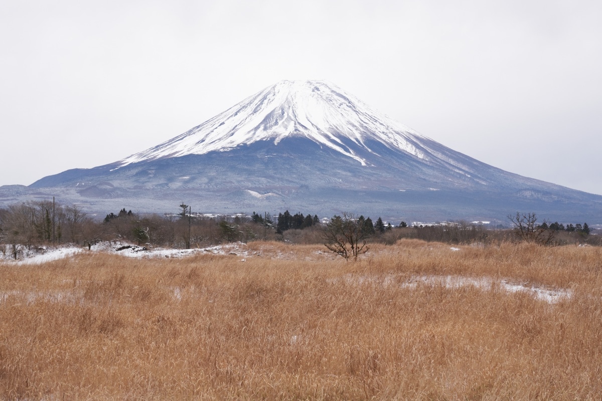
The most prominent feature of the park is, of course, Mt. Fuji. The geological history of the 3,776-meter peak goes back millions of years, but the familiar conical silhouette of today was formed by eruptions beginning as recently as five thousand years ago.
Photo: A view of Mt. Fuji from the Asagiri Highland.
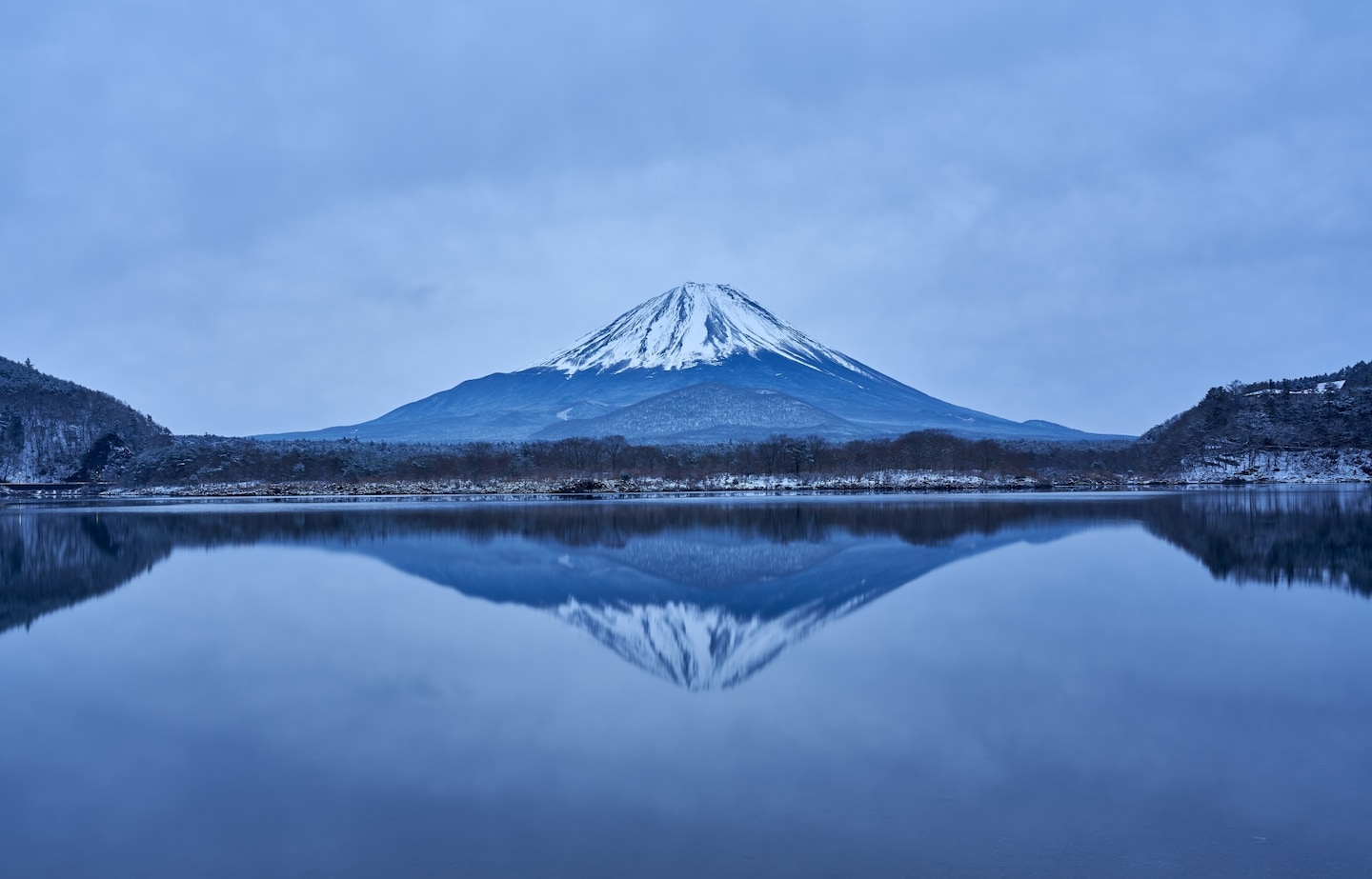
The neighboring landscape is even younger. The Aokigahara Jukai Forest or “Sea of Trees” stands on a lake of cooled lava from the Jogan Eruption of 864, which also helped reshape the area’s existing lakes and rivers into the familiar Five Lakes of today.
In Izu, one of the best views of Mt. Fuji is from the Heda region on the peninsula’s western coast. From this vantage point, the mountain rises majestically to the north across the waters of Suruga Bay, all framed by the verdant coastal beauty of Heda itself. Over in Hakone, when the air is clear, Mt. Fuji forms an arresting backdrop to scenic vistas like the waters of Lake Ashinoko, which lies within a volcanic caldera.
The Human Scale
People have always been drawn to Mt. Fuji, regarding it with both fear and awe. At the same time, the igneous landscape built up over centuries by eruptions and lava is part of the everyday life of nearby communities.
The two caverns in the igneous rock known as the Fugaku Fuketsu (Wind Cave) and Narusawa Hyoketsu (Ice Cave), are excellent examples. Both were formed naturally during the Jogan Eruption, making them of great interest to geologists. They were also used by locals as convenient cold storage facilities.
The Narusawa Ice Cave has a two-storied double ring structure, with mysterious vents leading to destinations unknown. As its name suggests, the interior is subfreezing all year round. Before the advent of electric refrigeration, ice was stored here for use in summer.
The Fugaku Wind Cave slopes more gently into the earth, and stays at a cool 3°C all year round. It was used to store nuts, seeds, and even silkworm larvae. When silkworms were brought out of the Fugaku Wind Cave, they responded to the temperature change as if spring had come. With careful planning and timing, year-round silk production was possible.
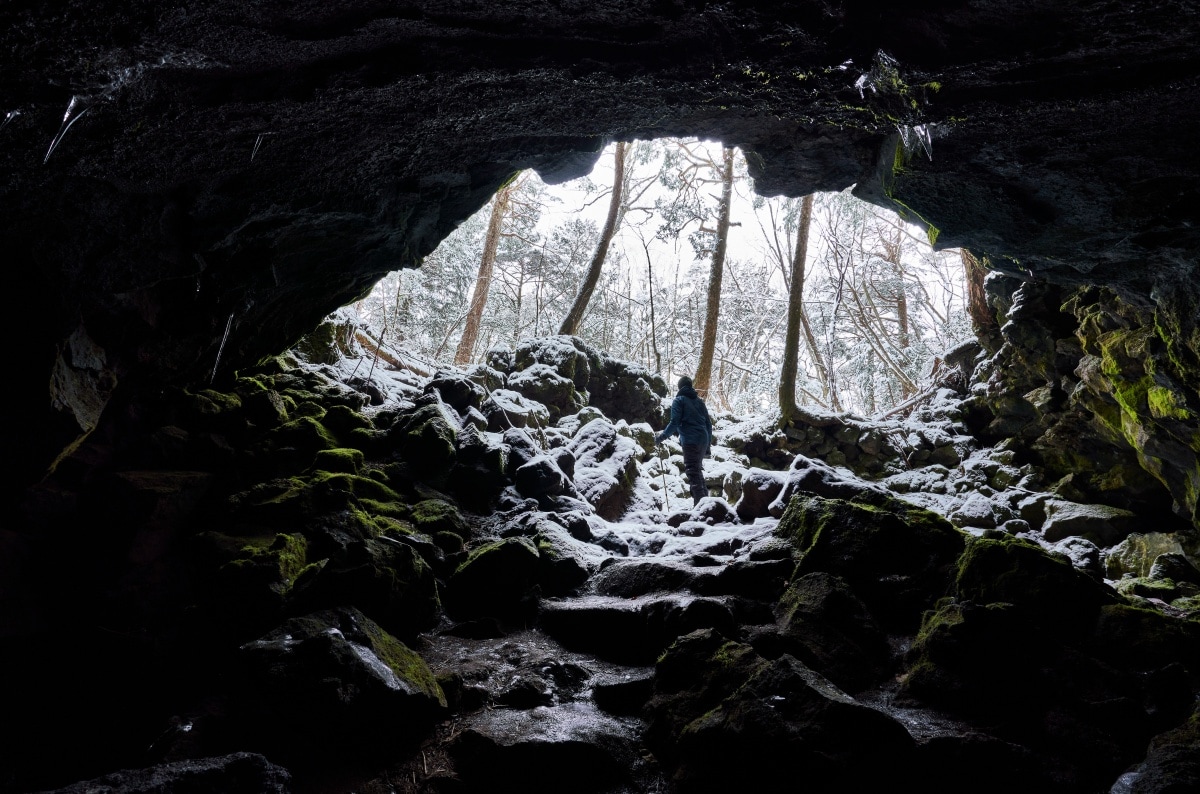
Another grotto, somewhat deeper in the Sea of Trees, was never used by humans, but did provide a home for another mammal: bats. The “Bat Cave,” as it is known today, has the unique property of remaining somewhat warmer than outside in winter, making it ideal for hibernation. Visitors during the daytime are unlikely to see any bats, which hide themselves well, but the cave itself offers an exciting but safe spelunking experience.
Hiking Around Mt. Fuji
Aboveground, too, the Sea of Trees is full of peaceful, leafy walking routes. Due to poor soil, most of the trees are hardy evergreen conifers like the Japanese red pine (Pinus densiflora), southern Japanese hemlock (Tsuga sieboldii), and hinoki false cypress (Chamaecyparis obtusa). Below, moss blankets the igneous rock, which is frozen in eerie ripples and cracks. The porous rock absorbs sound, deepening the silence, but the atmosphere is light and airy rather than oppressive. However, because the forest is large and uninhabited, visitors are urged to stay on the trails.
Partially ringing the mountain at the 5th Station level is a trail called the Ochudo or “Middle Route.” This originally went all the way around the peak, but an erosional valley known as the “Osawa Collapse” on the mountain’s west flank has now progressed so far that the circuit is too dangerous to complete. Today, visitors can stroll along a stretch of the Ochudo that lies right about the tree line, with green foliage below and the austere, rocky peak above. The view to the north is also spectacular, with clear visibility as far as the Minami Alps.
Photo: The Dragon Cave in Aokigahara Jukai Forest.
There are hiking opportunities all around the Five Lakes area for roaming the mountains under Fuji’s watchful gaze. Each lake has its own charms, from Yamanakako, the highest and nearest to the peak, to Motosuko, the westernmost and remotest of the five. Motosuko is also where Koyo Okada took his famous photograph “Lakeside Spring,” which appears in engraved form on the current design of the ¥1,000 bill. There is a well-signposted hike up from the lake’s shores to the exact vantage point where Okada may have placed his tripod. The hike is challenging, but gazing on one of Japan’s most iconic vistas is well worth it.
Discover all Fuji-Hakone-Izu National Park has to offer here!