See Kyoto Mapped as it Once Was
With all apologies to Nara, nowhere in Japan can match Kyoto’s reverent connection to its history. The city served as the seat of imperial power for centuries, most gloriously during the Heian Period (794-1185).
By SoraNews24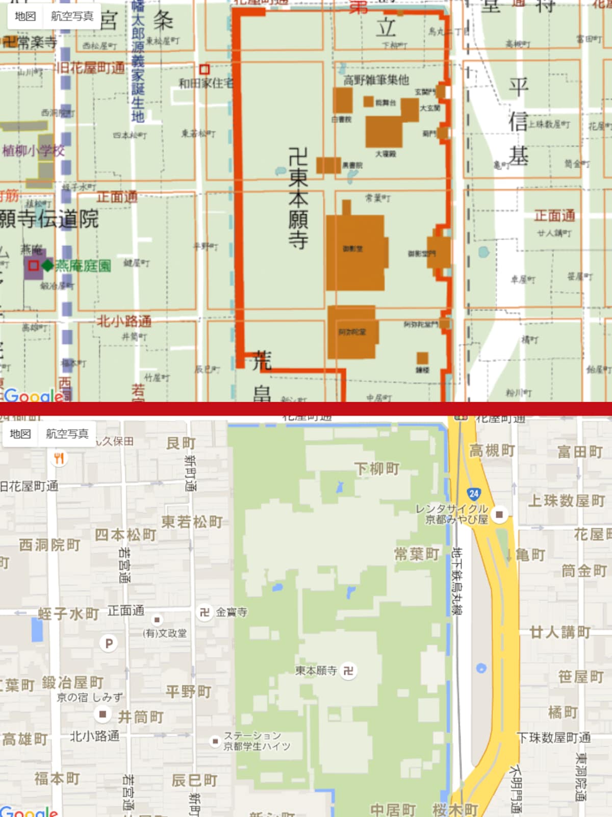
http://en.rocketnews24.com/2016/01/08/interactive-online-map-of-kyoto-lets-you-toggle-between-modern-day-and-the-9th-century/
Of course, some temples have held onto their lands. Higashi Honganji Temple (outlined in orange in the top picture), for instance, has been an influential and important institution for generations, and was as prominent a fixture of the old Kyoto cityscape as it is in the new.
http://en.rocketnews24.com/2016/01/08/interactive-online-map-of-kyoto-lets-you-toggle-between-modern-day-and-the-9th-century/
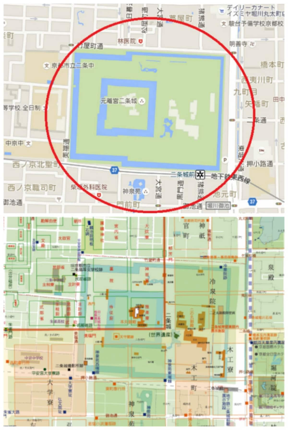
As a matter of fact, comparing certain addresses shows that Kyoto has even gained a few cultural properties through the years. Nijo Castle, one of the country’s best-loved fortresses, wasn’t built until 1626, so it doesn’t appear on the Heian-Period map.
http://en.rocketnews24.com/2016/01/08/interactive-online-map-of-kyoto-lets-you-toggle-between-modern-day-and-the-9th-century/
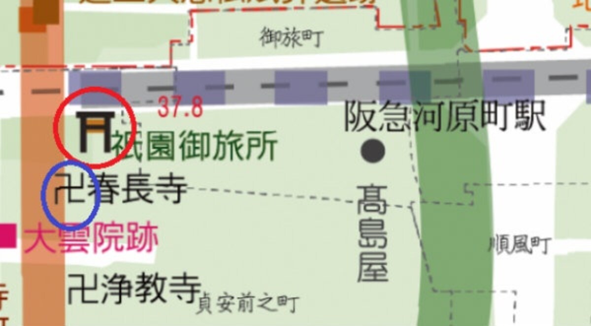
And sometimes the Heiankyo Overlay Map reveals some unexpected parallels between the past and present. In the area now known as the Kawaramachi entertainment district, sliding the slider to the Heian Period map shows a Buddhist temple (circled in blue) and Shinto shrine (circled in red) in close proximity, two technically competing yet coexisting providers of the same service.
http://en.rocketnews24.com/2016/01/08/interactive-online-map-of-kyoto-lets-you-toggle-between-modern-day-and-the-9th-century/
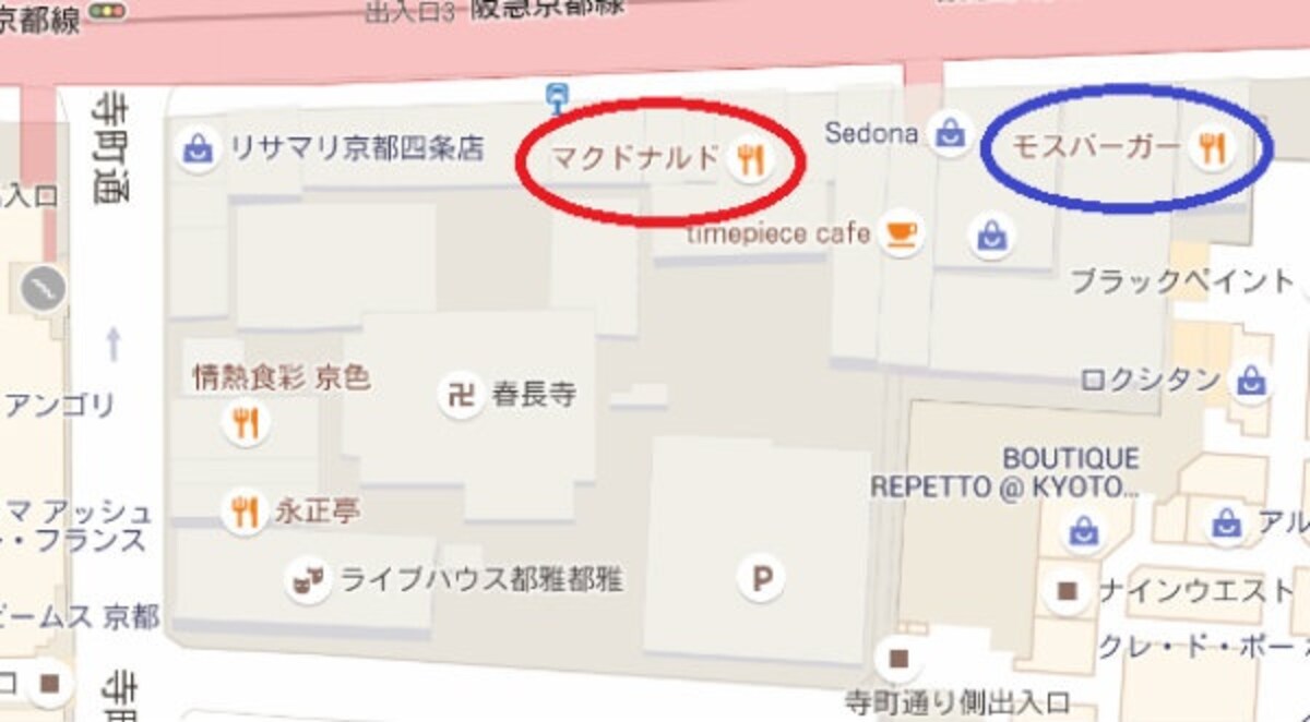
And what do we find just a stone’s throw away in the present day? A McDonald’s (in red) and a Mos Burger (in blue).
Truly, the more things change, the more they stay the same.
Related Stories:
Four awesomely beautiful shrines for your next trip through off-the-beaten-path Japan
Dress like an aristocrat from the Nara period at new costume rental shop in Nara
Travel through time with these old maps from the Zenrin Virtual Museum


