Rainbows and Resilience: Hiking the Michinoku Coastal Trail
The 1000-kilometer trail that hugs Tohoku’s Pacific coastline offers hikers some incredible natural scenery and dramatic evidence of the disastrous tsunami of 2011. Andrew Lee hiked some portions of the trail and shares his experience.
By Andrew Lee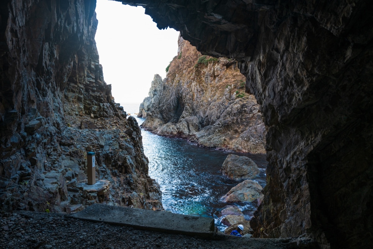
Exiting a tunnel under the Kitayamazaki Cliffs reveals a hidden cove that seems like something out of a fantasy tale.
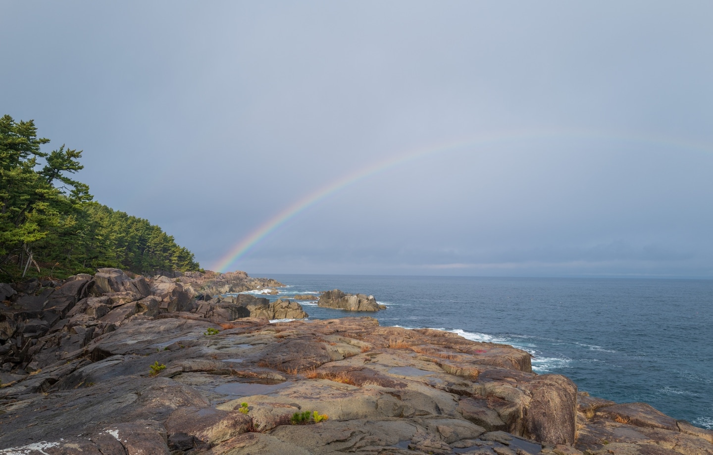
As we emerged from the coastal forest onto a large chunk of granite known as Samurai Rock, a light rain began to fall through the pale midday sun, and a brilliant rainbow suddenly broke out above us. Bands of color stretched across the sky in a perfect arc from the rock’s edge into the ocean, lingering long enough for me to imagine a pot of gold just beneath the waves. Then the rain turned to snow, and we ducked back under cover of the trees.
Samurai Rock lies on the Sanriku coast in Iwate Prefecture, on the North Kuji section of the Michinoku Coastal Trail (MCT), which I was currently walking. A sign by a trail marker explained that Nambu Toshinao—lord of the Nambu clan and the samurai the rock is named after—stopped by here back in 1614, and I wondered if he was as lucky as we’d been. Probably not.
Four days earlier, I’d taken the Shinkansen from Tokyo to Ichinoseki, to join a tour of the Iwate section of the trail. Since then, I’d walked through tunnels beneath the cliffs of Kitayamazaki and descended stone stairs into a hidden cove straight out of a Tolkien story. I’d heard tales of the tsunami that swept ashore here in 2011, and taken a boat ride through perilous rock arches. I’d also eaten copious amounts of incredible seafood, and sung karaoke in a bar with drunk salarymen. And before my trip ended at the trailhead in Hachinohe the next day, I was to meet a rockabilly bar owner as winter’s first snow blanketed the city.
Disaster memories: remnants of the tragic events of 2011
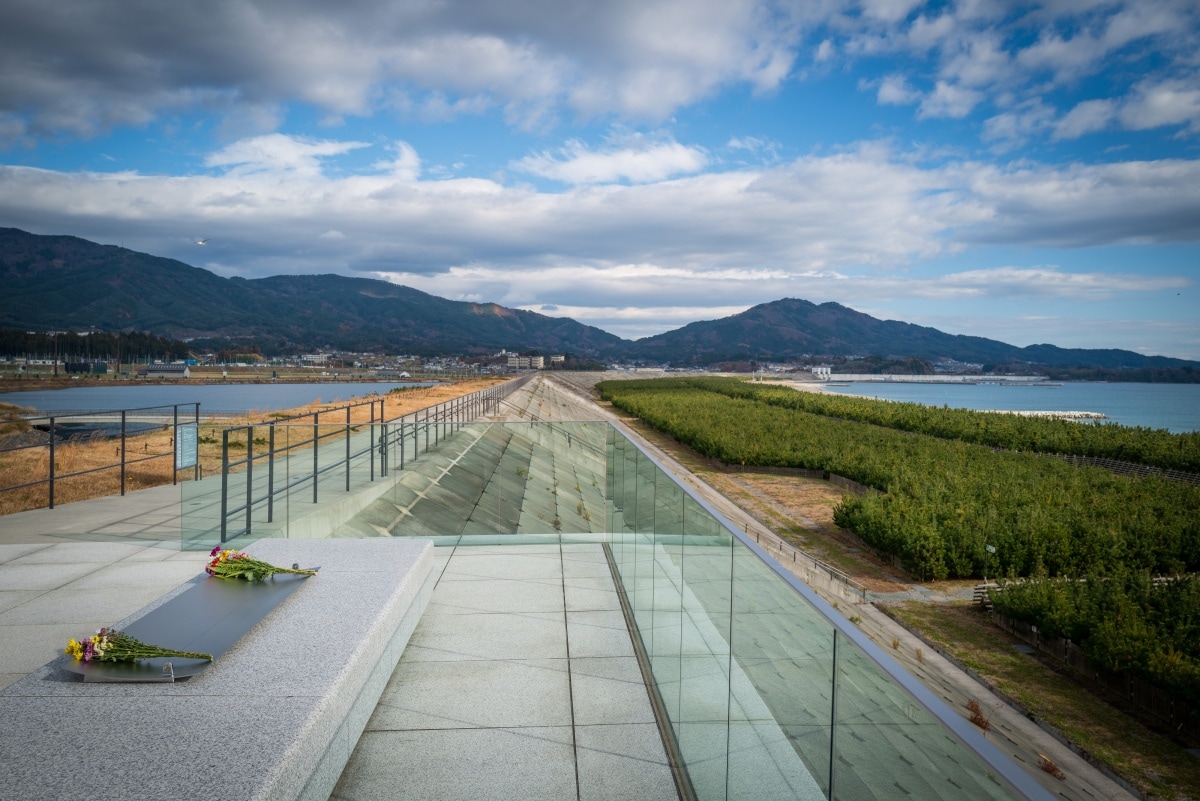
The seawall and tsunami memorial in front of the Tsunami Memorial Museum in Rikuzentakata, Iwate.
The last time I was in Tohoku things were very different. It was June 2011, just three months after a horrific earthquake and tsunami had devastated the region. Like thousands of others I came to help clean up the debris. Ishinomaki, in Miyagi Prefecture, where I was based, was one of the hardest-hit areas. Iwate’s Rikuzentakata was another, and it was there, at the Tsunami Memorial Museum, that my guide wisely began our tour of the MCT, which runs along the road in front of the museum.
While walking the trail, it’s near impossible to ignore the events of March 11, 2011, when a magnitude 9.1 earthquake hit the region, creating a tsunami that reached up to 40 meters in height and washed away whole towns, killing over 20,000 people. Evidence of the disaster is everywhere, from the signs that mark the height of the waves’ advance to the huge new seawalls lining the coast like something from a science fiction movie.
At the same time, it is remarkable to see how the area and its people have recovered. Much of the lowland inundated by the tsunami has been repurposed for farming or recreation, and residences, schools, and hospitals have moved to higher ground. In many ways the region has moved on, and the trail, which opened in 2019, was created in part to encourage people to visit the area, aiding its continued recovery.
Stretching 1,000 kilometers from the northern trailhead in Hachinohe, Aomori Prefecture, to the southern trailhead at Soma, Fukushima Prefecture, the trail mostly follows the coastline, passing through ancient pine forests atop 200-meter-high cliffs, down to pebbly beaches, and through hand-carved tunnels into fishing villages and backyards, where old women tend their vegetables.
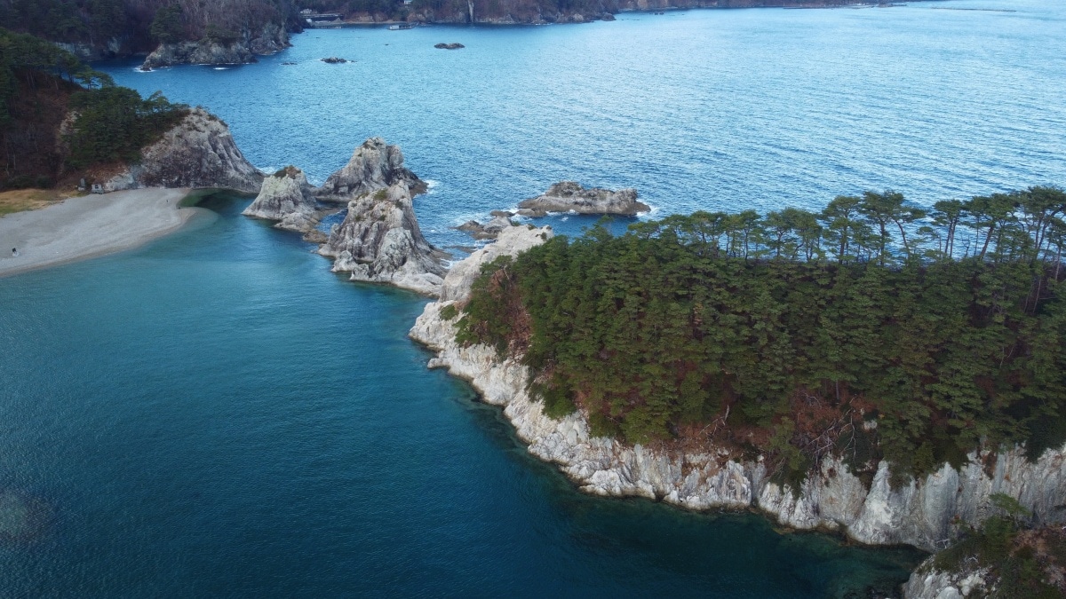
The MCT passes through Jodogahama, which means “Pure Land Beach,” and was named in the 1680s by a priest who decided the jagged islands of white rock rising from the emerald blue water resembled the Buddhist concept of paradise.
The first day’s hike was a short course between Ono Kaigan beach and Kurosaki Senkyo, where there is a welcoming public onsen. On the way, I was told the distinctive rias coastline in the area was formed 10,000 years ago, as melting glaciers caused sea levels to rise, submerging river valleys. I spotted evidence of wildlife long the path, such as fresh mole holes, and piles of turds that tanuki (raccoon dogs) leave to mark their territory, as well as a tree with a bear’s claw marks, which made me a little nervous.
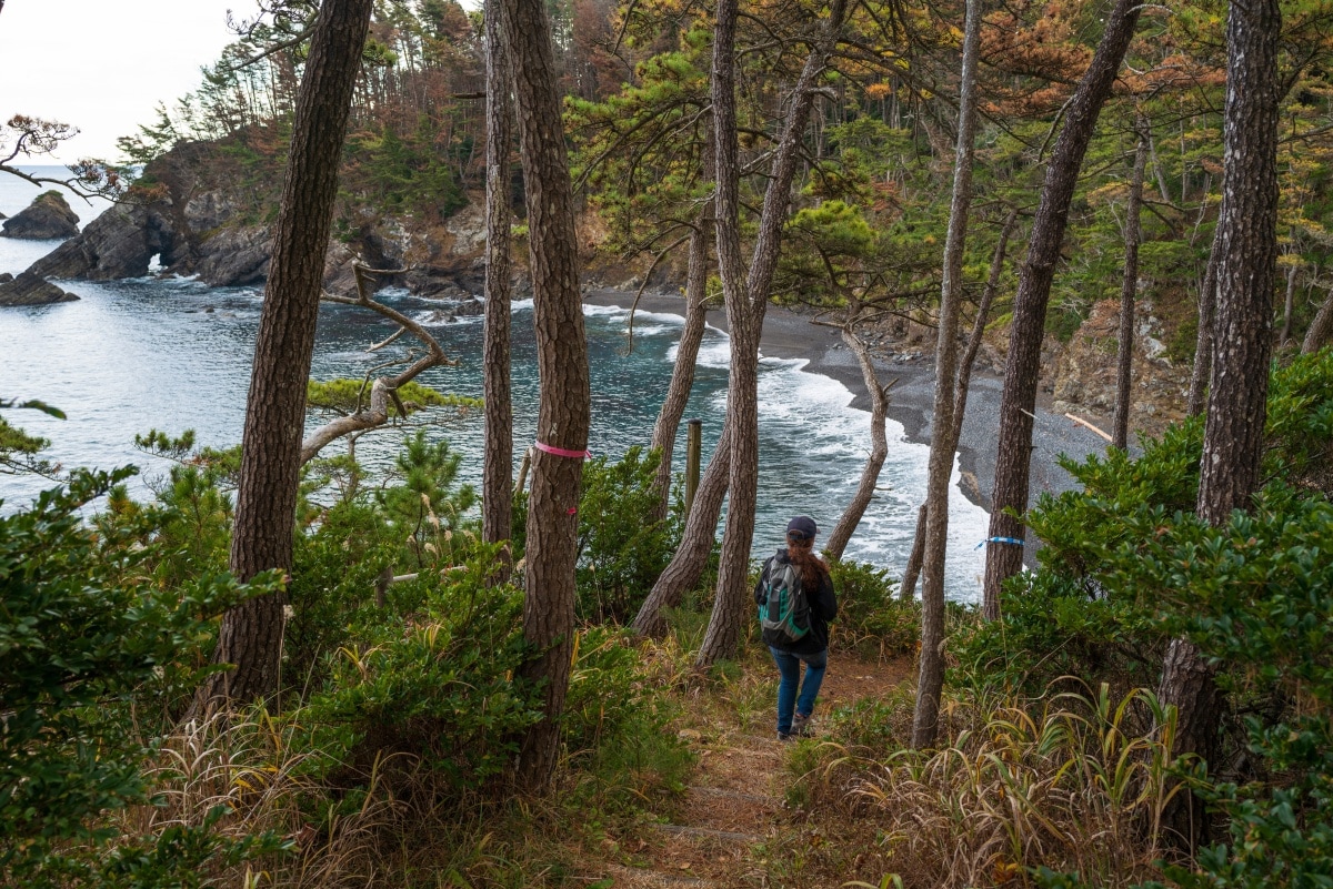
The section of the MCT between Ono Kaigan beach and Kurosaki Senkyo winds through the forests and pebbly beaches of the Sanriku coast of Iwate.
The next morning, I stood at the window of my third-floor room at Horaikan Inn in Kamaishi. It had rained overnight and I could see the damp concrete path that’s part of the trail tracing the shore of Otsuchi Bay. The morning sun reflected off the water, filtering through pine trees in front of the hotel. Among them stood a slab of polished stone etched with the kanji characters for 2011—a memorial to the tsunami.
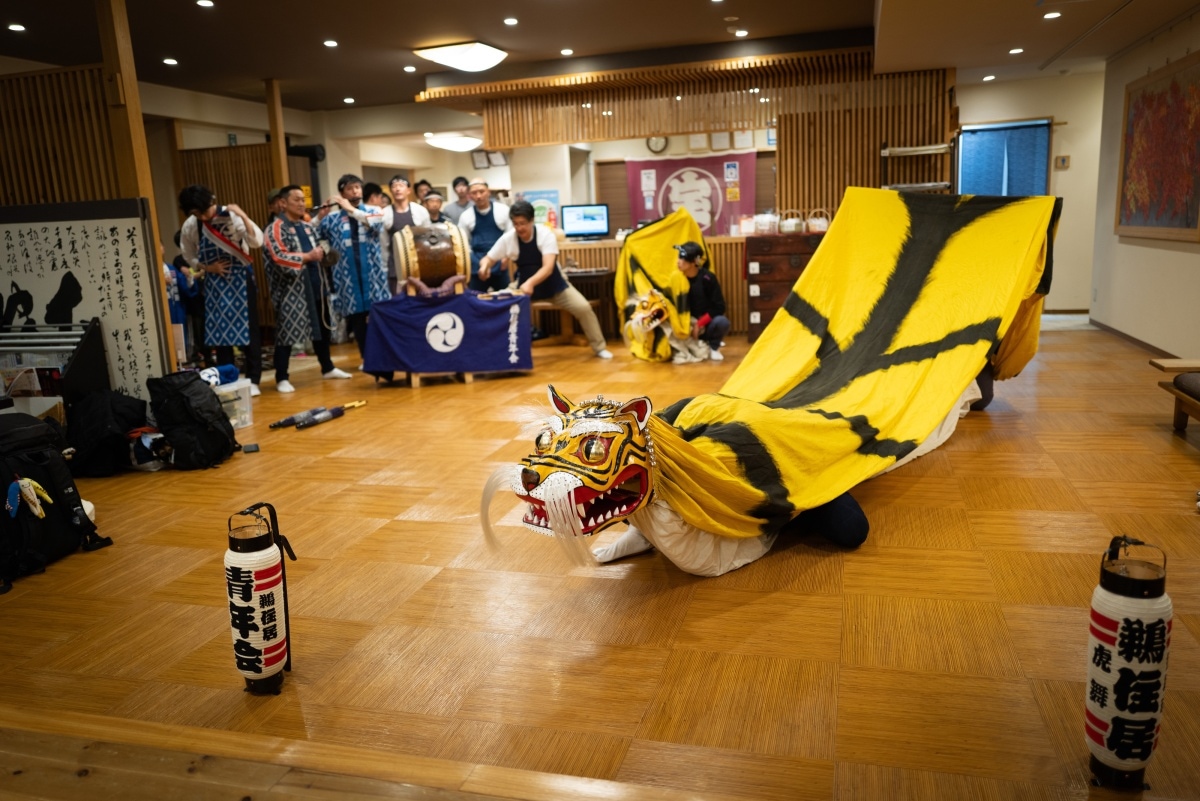
After the tsunami, Horaikan became a lifeline for those who took refuge there. Its connection to the community remains strong and the local Toramai dance group is often invited to perform Kamaishi’s famous tiger dance for guests.
I thought about the video I’d been shown the night before, showing people fleeing as water surged through those same pines and into the hotel. It was odd to stand there looking at such a lovely view and ponder how quickly life can change. But, as I was learning, that’s part of walking the MCT—while you wonder at the nature you also marvel at its power. You also discover how resilient and warm the people of this region are, such as Akiko Iwasaki, the charming owner of Horaikan.
Iwasaki was 54 when the tsunami came, and she shares her remarkable story so people will know what to do if it happens again. “That’s me,’” she says pointing to one of the people running through the carpark in the video. You can hear someone yelling for her to hurry, as water begins to push cars and a bus towards her. But the wave washes her away. That she’s alive to tell us the tale is a miracle, and I was in awe she could remain so vibrant and positive.
When we checked out, Iwasaki wished us bon voyage by waving a large, brightly colored flag, as is done when local fishing boats head out each morning. She stood in the middle of the road with her big smile, waving that flag until we were out of sight.
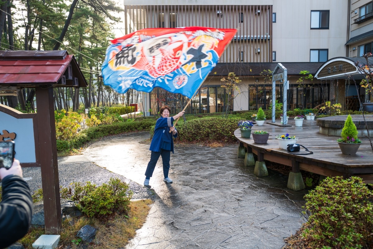
Tsunami survivor and owner of Horaikan Inn, Akiko Iwasaki, waves a flag to farewell guests when they checkout.
Buddha’s beach: the striking beauty of the “Pure Land”
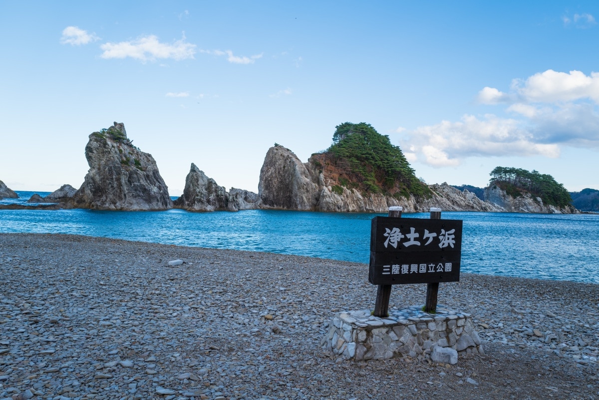
Jodogahama Beach is a popular swimming spot in the summer.
That day we hiked the Miyako section of the MCT between Shiofukiana Blowhole and Jodogahama Beach. The temperature had really dropped and I wished I’d brought better gloves with me. But even the torrential rain that fell briefly could not stop the trail from drawing me into that contemplative state of calm I associate with a good hike. I held back from the group, and took in the view of the ocean through the trees while I walked in silence—listening to the whistle of the wind through the pines, and the rhythmic clatter of waves stirring pebbles on the beach below.
From Takanohama, the trail entered a long tunnel that came out near the Jodogahama Rest House, where we were treated to “bin-don” for lunch. It arrives with the fresh seafood arranged in layers inside a sealed milk bottle. You then tip the diced fish, octopus, seaweed and so on, onto a bowl of rice, arranging it as artistically as you can before scoffing it down.
I imagined a great backstory to this dish when I first saw it: perhaps a local fisherman thought it easier to carry his lunch stuffed into a bottle than a bento box. But alas, I was told it was dreamed up as tourist attraction, although it does have its roots in the fresh uni (sea urchin) that is sold in glass bottles around here. It was delicious, though, and is already a hit on social media.
The beach itself is incredibly photogenic. Jodogahama literally means “Pure Land Beach,” named in the 1680s by a Zen priest who decided the jagged islands of white rock rising from the emerald blue water resembled the Buddhist concept of paradise. Walking along the edge of the serene bay, I could understand what he was thinking.
That night we stayed at an old business hotel in Miyako City. After dinner at a local izakaya, I somehow ended up in a “snack” bar, as old style drinking joints are called in Japan. Karaoke was inevitable. Highballs flowed, and the songs got louder and more raucous. One old dude I nicknamed ‘snake hips’ belted out classic metal tunes while playing some serious air guitar, and I couldn’t resist punching in the Japanese punk classic “Linda, Linda, Linda” by The Blue Hearts, which had the intended effect, as everyone jumped up and screamed along.
A hard-day’s hike: the spectacular cliffs of Kitayamazaki:
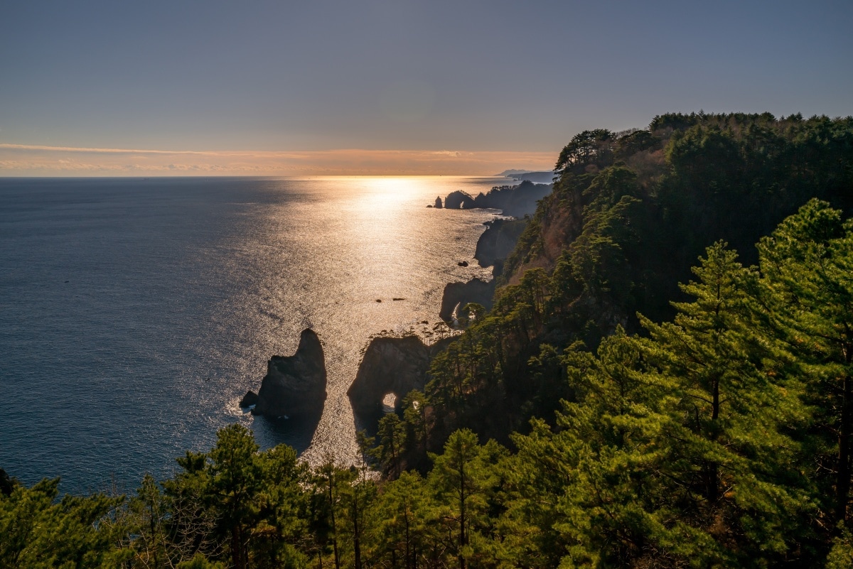
The view from the Kitayamazaki Visitor Center, with stone arches along the coast silhouetted at sunrise.
The fourth day was definitely the hardest, not least because I was horribly hungover. But it was also the most memorable. Our starting point was the Kitayamazaki Visitor Center, which has a spectacular view from its observation deck. We’d timed it so the morning sun reflected off the ocean, silhouetting the rock arches along the coast as far as Tsukue-hama Beach, where we would end the day’s hike.
The Kitayamazaki cliff section of the trail is notably difficult, with long steep stairs to the coves it passes through, and even steeper ladders back up the cliffs, as well as dark and scary tunnels where a headlamp is essential. But the effort is worth it. I lingered where a stone staircase descended from the inky blackness of a tunnel’s mouth into a cove lit by the golden afternoon sun. The rocks seemed to glow orange, the water deep blue and magically clear. It genuinely felt like a scene from a fantasy film.
With us that day was a guide from the visitors center named Nanami Takahashi. On March 11, 2011, she was fourteen, taking part in the annual clean-up of this section of the coast with her junior-high school classmates. As her class was picking up the rubbish, one girl suddenly yelled ‘Quake!’ as a huge portion of the cliff crashed down at the far end of the beach. One of the teachers realized a tsunami could come, and suggested they escape back to the bus, which was beyond the two tunnels they’d come through. The kids were terrified of being trapped by a tsunami and wouldn’t budge. Another adult then remembered another old path, and quickly ushered the teens up the steep slope.
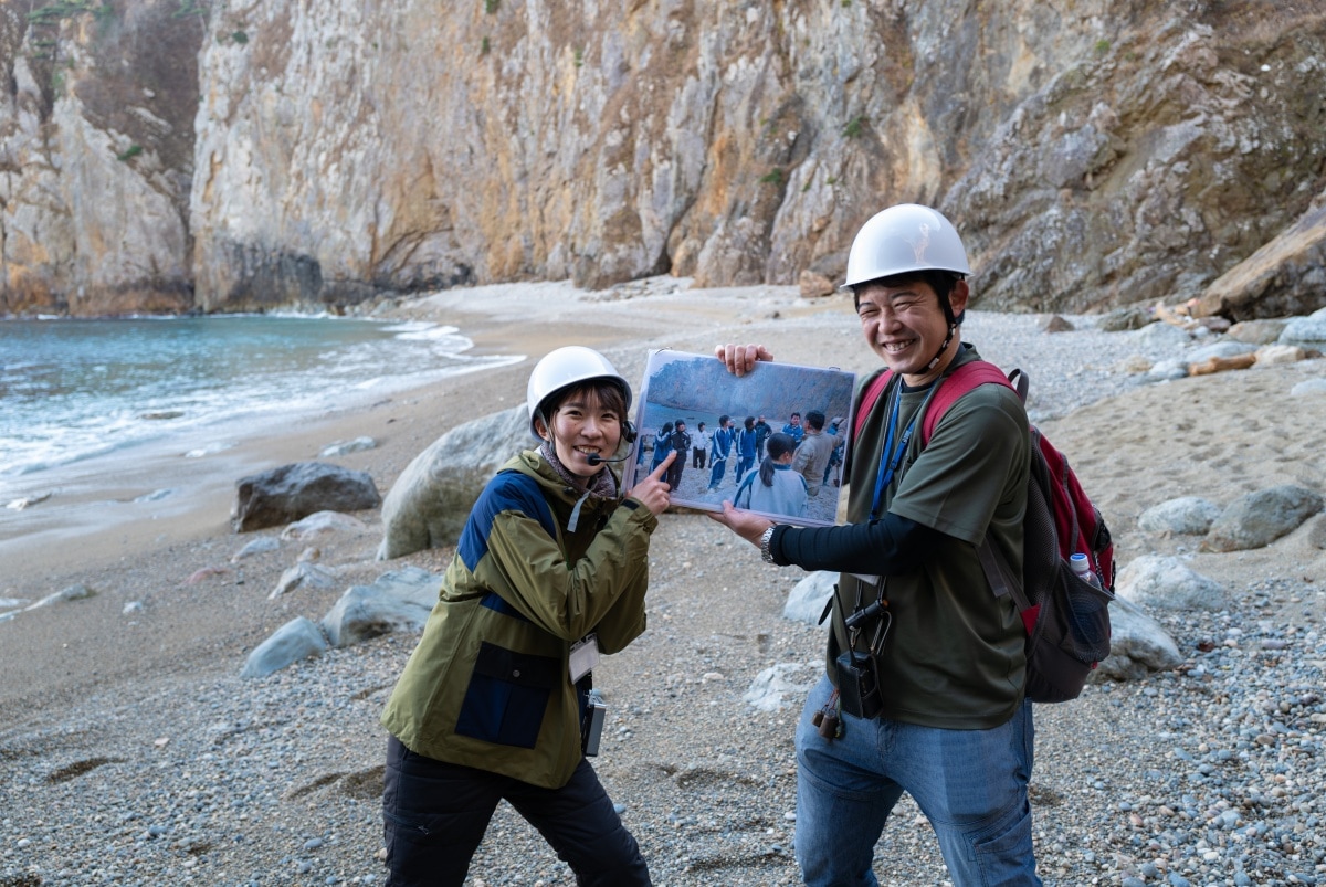
Trail guide Nanami Takahashi (left) points to a photo of herself at the location where she experienced the March 11, 2011 earthquake as a highschool student. With her is fellow guide Kouta Akasaka.
That path is now part of the MCT. It follows the same route they took to the fishing village where a bus was waiting, carrying them to safety only minutes before the tsunami arrived.
I noticed a marker showing how high the tsunami had reached, and looked down at the fishermen’s huts 30 meters below. For the second time that trip I thought how luck is all in the timing.
That night I stayed at Hiraigakaiso, a pleasant minshuku in Tanohata. The first thing I did was take a long soak in the inn’s shared bath. After the hike, I'd joined a scenic boat ride beneath the cliffs that had been spectacular, but bitterly cold. The huge tub, made entirely of stainless steel, made me feel a little like I was simmering in a pot, but after hours of shivering, it was exactly what I needed.
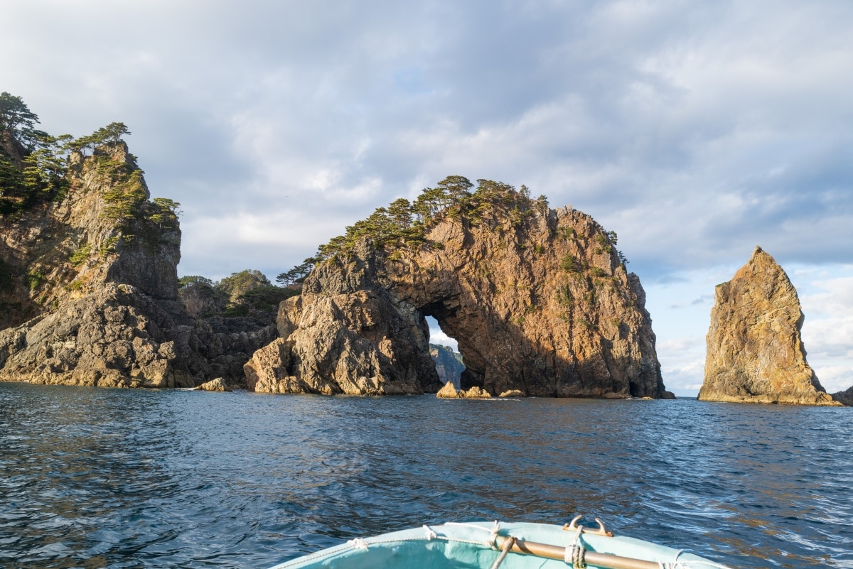
Boat rides with local fishermen are a good way to see the coast beneath the Kitayamazaki Cliffs. If conditions are right you can pass under some of the many stone arches and even enter the area’s own “Blue Cave,” reminiscent of the Blue Grotto in Italy.
Dinner was served in the dining room, where the minshuku’s owner had thoughtfully drawn a map of the impressive meal on a whiteboard, complete with English descriptions: grilled Ichiji rockfish, sea eel, assorted sashimi, and a salmon hotpot—all fresh from the local fish market that morning. I did think that perhaps one item in the diagram could have read “sunfish,” rather than “sunfish intestine.”
Snowfall and decorated trucks: the end of the line
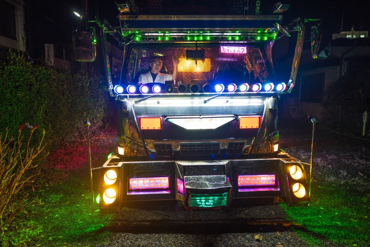
“Nobu,” the owner of a friendly izakaya in Kuji, Iwate, shows off his “art truck” (decotora), which he drives to the fish markets early each morning.
After watching the sunrise from the beach the next morning, I caught the cute one-carriage train to Kuji on the Sanriku Rias Line. The plan was to walk the section from Takanoki to Honami Port, but not long after the rainbow at Samurai Rock, the snow became too heavy to continue. We sheltered at Samurai Rock Campground for lunch and warmed up with hot Mamebujiru, Iwate’s famous soup with vegetables and walnut dumplings, before heading back to Kuji for our last night.
Dinner that evening was at a local izakaya called Nobu. Its walls were lined with plastic toy figures from “Kamen Rider,” the popular masked-hero TV drama from the 1970s. Alongside these were models of gaudy delivery trucks customized with angular panels of chrome, brightly colored lights and painted with scenes from Japanese folktales.
As we paid our bill I asked the proprietor—who admitted he was the Karmen Rider fan—if he’d been a truck driver before opening his bar. “I still own a truck,” he said. “I drive it to the fish markets each day. Want to see it?” We headed outside to the carpark, where he climbed into the cabin of his truck and started it up, flicking switches to dozens of lights until the truck was glowing in the darkness. Nobu sat grinning in the driver’s seat and gave me a thumbs up.
As we walked back to his restaurant he corrected my description of his truck as a “deko-tora,” a popular term that is short for “decorated truck.” “We call them art trucks now, because they’re works of art.”
The next morning the countryside was covered in snow, so my final hike was reduced to a short stroll along the shore, finishing at the trail’s northern trailhead in front of Kabushima shrine, in Hachinohe. As I walked that last stretch of the trail I thought back on everything I had experienced on the trip.
Living in Tokyo, it’s easy to forget that so much of Japan is covered in forests, and I’d had no idea that the Sanriku coast was so beautiful. My memories of Tohoku had previously been tainted by what I saw there after the tsunami, but now I had a new perspective. Walking the Michinoku Coastal Trail gave me a chance to see the region in a new light, colored by rainbows, golden sun, and a just a touch of neon.


