Walk Tohoku's Historic Michinoku Coastal Trail
The Michinoku Coastal Trail runs over 1,000 kilometers (600+ miles) through the wild nature and communities found in the Tohoku region of northern Japan. The trail starts in Hachinohe, in Aomori Prefecture and runs to the city of Soma in Fukushima, making it one of the longest and most stunning routes in the country—and you can do it all on foot!
By DavidA Long Old Walk
http://tohoku.env.go.jp/mct/sp/english/
Ascetic monks have roamed the lands Japan since ancient times, setting off on spiritual pilgrimages that were as much a test of physical endurance as test of devotion to the gods. This tradition of walking, trekking and hiking continues today; so much so that a consortium of 25 walking trails, called the Japan Long Trail Association, was established in 2011 to support on-foot tourism.
One of the finest newest and most diverse trails in the nation, is the Michinoku Coastal Trail in northern Honshu's sprawling yet sparsely populated Tohoku region. Michinoku is an old name for the Tohoku region that literally means "the end of the road," and the Coastal Trail follows the Pacific Ocean coastline line along the neck of Honshu through four prefectures: Aomori, Iwate, Miyagi, and Fukushima.
Significant chunks of Japan's northeastern coastline were devastated by the 2011 earthquake and tsunami that rocked the nation. So not only is the walking trail a perfect way to travel in this new socially-distanced world, but you can also give back to the rural communities still working to recover some nine years after the disasters struck.
The Journey
https://www.youtube.com/watch?v=2WTanGbqF3Y
Opened in 2019, the Michinoku Coastal Trail starts in Hachinohe City in Aomori, and runs for over 600 miles before culminating in Fukushima's Soma City. But as Ralph Waldo Emerson said, "It's not the destination, it's the journey." And on the Michinoku, you can have quite the journey indeed.
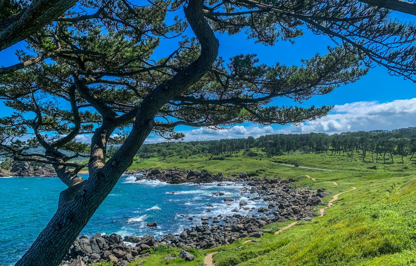
Wild and sprawling landscapes are par for the course, sinc the coastline is relatively undeveloped compared to other parts of the country. The Tohoku region's remoteness is exaggerated by the fact that few outsiders venture there: as little as 2% of foreign travelers visit during their travels in Japan.
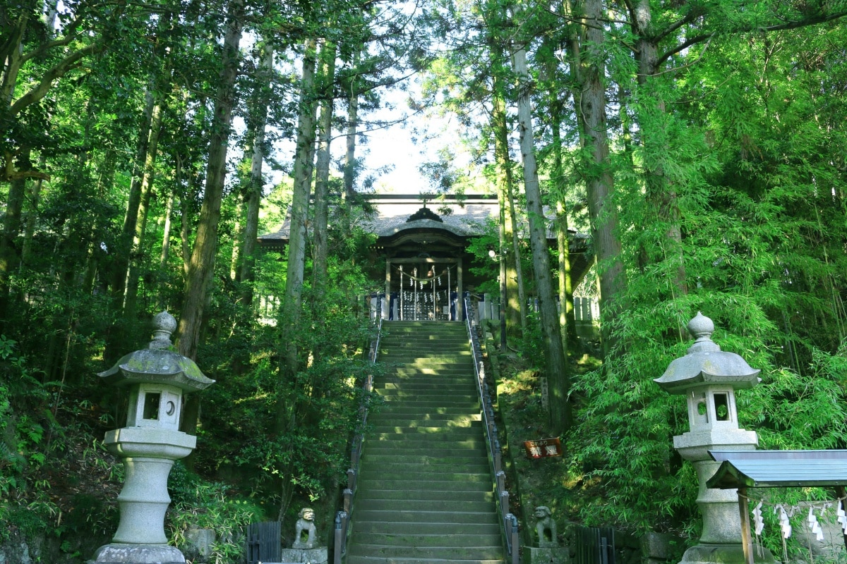
But you may begin to wonder why, as you stroll past aggressively beautiful seascapes and centuries-old shrines, or as you trek along string-thin paths coursing through wooded hills where the red-gold morning sun slices through the foliage overhead. If that sounds like you're cup of tea, read on for a look at some of the top spots along the Michinoku Coastal Trail:
Aomori Prefecture
Kick-off your journey in Aomori's Hachinohe City, lying just south of the Shimokita Peninsula on Honshu's most northerly tip. Fun fact: A quick scan of a map and you'll notice the protruding landmass bears an uncanny resemblance to a broad axe, which earned it the nickname, "Broad Axe Peninsula."
The Aomori section of the coastal path more closely resembles Ireland's Wild Atlantic Way or the craggy landscapes of northern Scandinavia, than what is typically associated with the Japanese coastline. One of the first landmarks you will pass (and officially the most northern point of the trail) is Kabushima Island, home to an estimated 30,000-40,000 black-tailed gulls which call the ancient local shrine home. For the best views of the Tanesashi Coast which covers this portion of the trail, you'll want to head for the Ashigezaki Viewpoint just a few miles southward. A former naval observation post, the stone lookout is the perfect place to take a rest and admire 360-degree views of your postcard-worthy surroundings.
The Michinoku Coastal Trail is indicated by wooden post markers bearing identical designs, looking like vertical blue squiggles. Follow these for another six miles and you'll reach Hamagoya, a thatched-roof fisherman's hut built during the Edo Period (1603-1868). If you wish to venture inside the building and have a look at the fishing tools of yesteryear, you'll have to contact the Hachinohe Museum.
In Aomori you can also hike the 740-meter tall Mt. Hashikamidake from the trail. The mountain's summit casts it's gaze across all points of the compass, from the vast Pacific Ocean to the mountains and pine forests enveloping Honshu. The hike is likely to take up a good chunk of time and stamina, though there are campsites nearby where you can sleep under star-flecked skies.
Iwate Prefecture
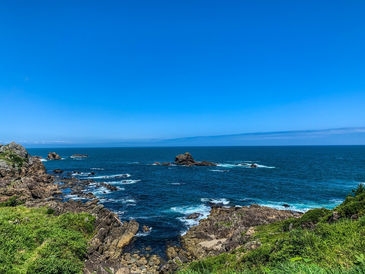
Iwate Prefecture gained attention on the world stage during the 2019 Rugby World Cup, when Kamaishi City was scheduled to host two games during the sporting showcase (unfortunately one was cancelled due to the super typhoon, Hagibis, which raged up the country in October). Beyond that small city on the Sanriku rias coast, Iwate is still largely unknown to Japan's foreign visitors. However, it is the country's second largest prefecture and forms the largest portion of the Michinoku Coastal Trail.
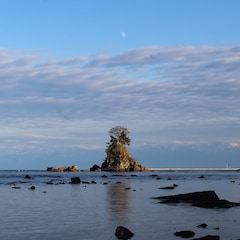
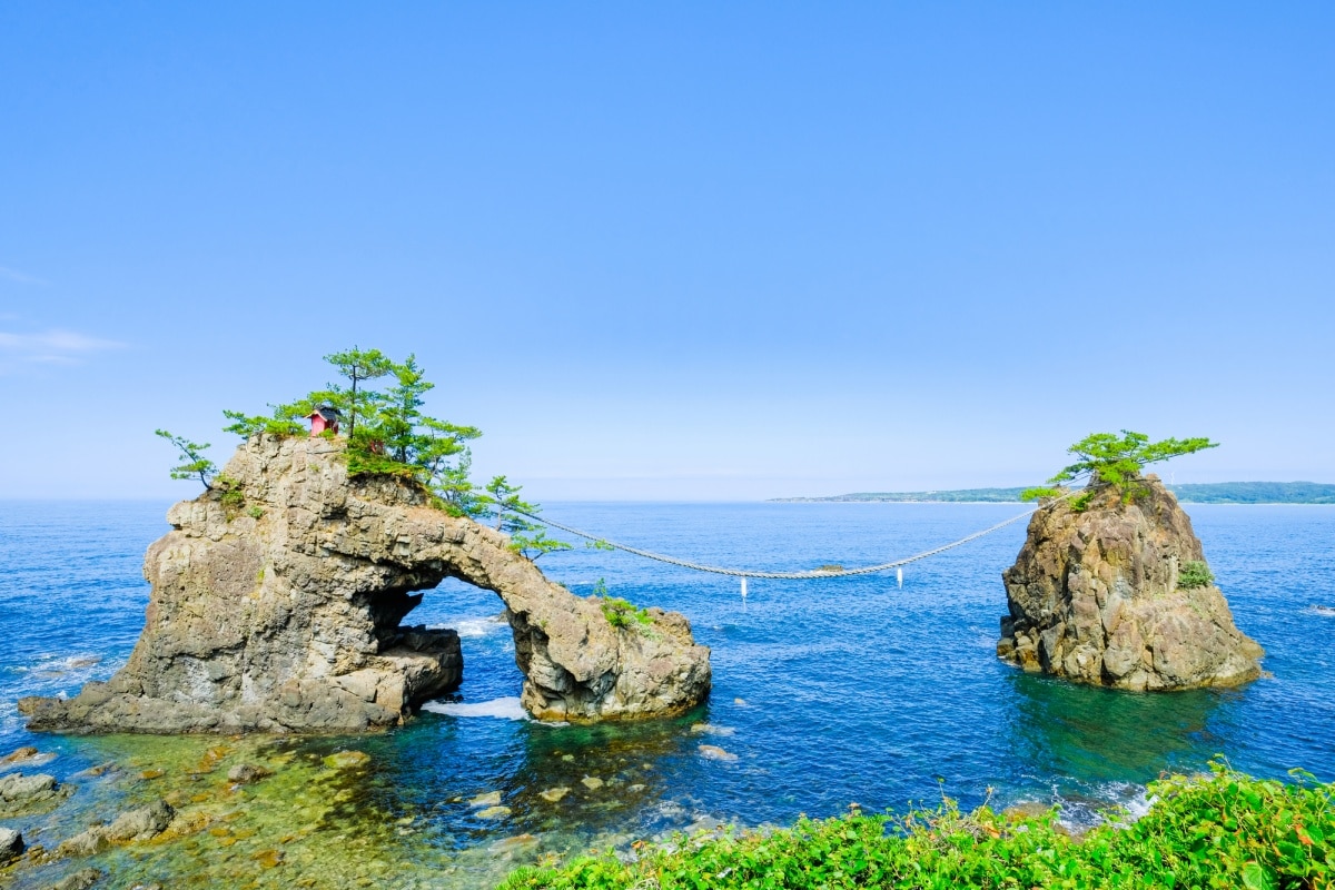
With hundreds of miles of coastal path, picking must-visit spots in Iwate is considerably more difficult than in the short section within Aomori. Yet the land flanking the sea abounds in prehistoric beauty, with its jagged headlands and frothy waves bashing against towering bluffs. It's hard to believe the people living in the scattering of charming fishing villages wake up to this kind of scenery every day. One of the most iconic coastal views is in the north of the prefecture: a trifecta of rocks known as Sannoiwa, featuring "Taikoiwa" (the taiko drum; 17 meters tall), "Otokoiwa" (the male rock; 50 meters tall), and "Onnanoiwa" (the female rock; 23 meters tall), from which you can gape in awe at the sunrise painting the sky in dreamlike hues.
The section passing through Kamaishi is also one of the trail's most popular, home to the sweeping birdlike form of the Recovery Memorial Stadium. Built in the wake of the 2011 earthquake and tsunami, the rugby stadium is both an architectural gem and symbol of solidarity for the local populous. 30 miles to the south you'll find Rikuzentakata, a town of 20,000 inhabitants where the most enduring symbol of the disaster recovery stands. The pine forest banking the coast was flattened in 2011 by gargantuan waves traveling at over 400 mph; all but for one tree. The tree was embalmed to fix its roots, which were poisoned from salt water, and once again stands tall by the water's edge. Its name: Miracle Pine.
Miyagi Prefecture
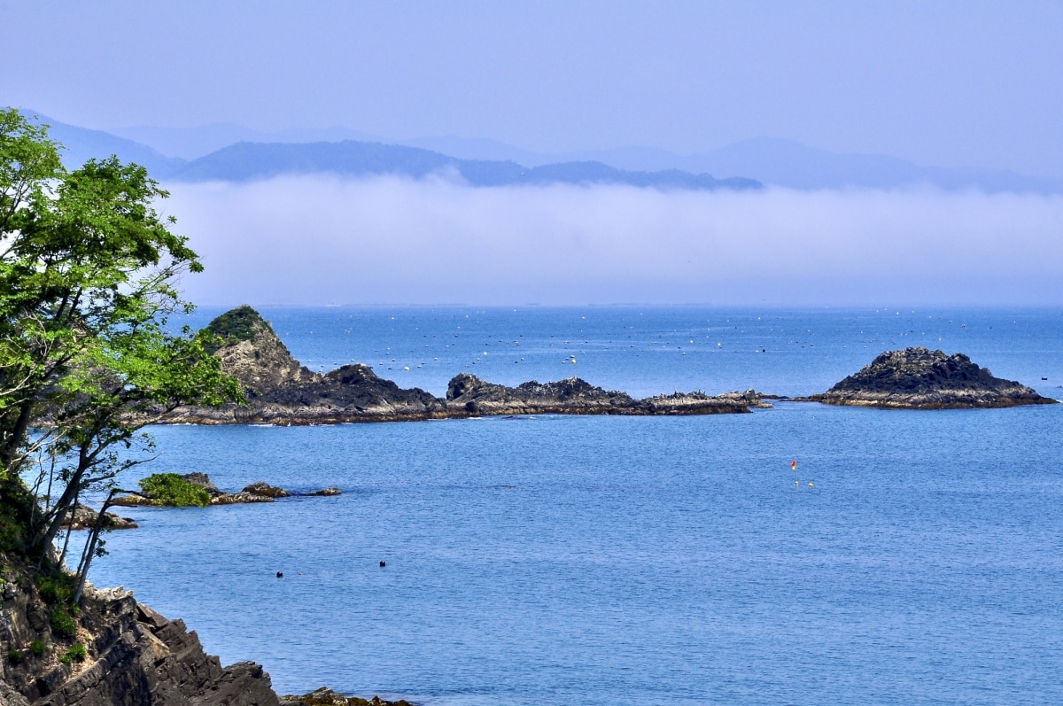
Home to the hustle and bustle of Sendai, the Tohoku region's largest city, and some breathtaking coastal topography, Miyagi Prefecture is slowly growing in popularity with foreign expats. The Miyagi section of the Michinoku Coastal Trail traverses some of finest seascapes in all of Japan, along with a raft of swim-friendly beaches and campgrounds.
It's impossible to visit the coast of Miyagi and not visit Matsushima Bay, an area of 260 conifer-topped islets protruding from a looking glass sea. It was said to have left Matsuo Basho, the founding father of haiku poetry and a man renowned for his verbosity with pen in hand, utterly speechless. In honor of the poet's magnum opus, The Narrow Road to the Deep North, written as he passed through the region in the 17th century, a Matsu Basho boat tour is available with tickets ranging from ¥1,500-2,900. Of course, if you want to stick to the trail on-foot here, you'll still be rewarded with picture-perfect views. And if you fancy a dip in the placid waters, head over to Tsukihama Beach on the bay's opposite side.
While in Miyagi, a trek along the Onagawa section of the Michinoku Coastal Trail, which climbs over undulating ridges in view of the Pacific, and a visit to Sendai in the south for a night on the town or a day of culture, should be other notable additions on your to-see list. When in Sendai, don't miss on out local specialty, aoba gyoza (green leaf gyoza) dumplings—they're worth the detour alone.
Fukushima Prefecture
The Michinoku Coastal Trail end point is situated in Soma City in northern Fukushima Prefecture, approximately eight miles from the Miyagi border. Though "Fukushima" has become shorthand for "nuclear disaster," that misconception overlooks the fact that the prefecture is one of the most scenic stretches of Japan, graced with a wealth of natural reserves.
In the Shinchi section of the trail, you can hike Mt. Karo, where the god Tenaga Myojin is said to reside alongside his spiritual companions, a deer and a wolf. Several easy walking routes lead to the mountain's 430-meter peak, which is best visited during the fall foliage season when autumnal colors shade the trees in the surrounding forest canopy.
On approach to Soma City you'll pass by the Shirahata ginkgo tree; also best viewed in autumn when the leaves take on a regal golden glow. The 240-year-old tree has passed into legend, said to have sprung into existence from a riding crop that the founding samurai of Sendai, Date Masamune, thrust into the ground. A torii gate and small shrine now commemorate the mythos of the tree.
Unfortunately the journey must come to an end some day, and on the Michinoku Coastal Trail that comes to pass in Soma, where the Nakamura Castle ruins are the symbol of the city. Originally built in the early 1600s, the castle served as a ruling center for over 200 years. After surviving wars, fires and natural disasters, it was eventually pulled down following the Meiji Restoration of 1868, when the emperor attempted to erase all remnants of feudalism and the former ruling elite. All that remain of Nakamura Castle are the Ote-ichimon main gate and parts of the walls and moats.