6 Great Nature Hikes Close to the Shinkansen
These hiking routes make it convenient to explore Japan’s natural surroundings. No long drives to get out to the countryside, no great changes in altitude, and there’s always a good view waiting at the top. The trails are sign-posted, well-maintained, and many pass through historic districts and are tailored for sight-seeing by foot.
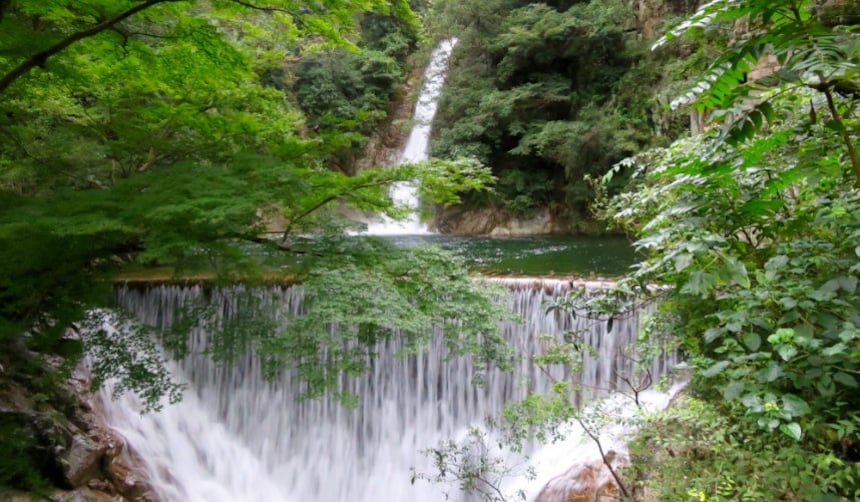
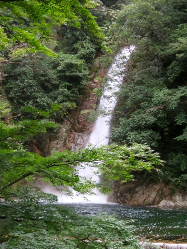
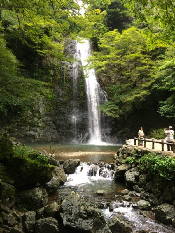
1. Nunobiki Falls (Hyogo)
http://en.rocketnews24.com/2015/09/23/five-nature-hikes-and-trail-runs-just-off-japans-bullet-train/
Thanks to Japan’s abundant rainfall and lush mountains, you’ll find waterfalls almost everywhere you go. Located in Kobe, the Nunobiki Waterfall hike offers three falls along the way, but the Nunobiki Falls trail is all paved, in some way or another, and is all uphill.
You’ll find a map of the Nunobiki Falls course here.
2. The Kyoto Trail (Kyoto)
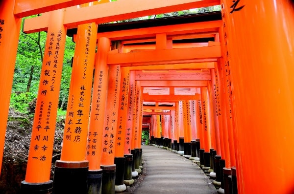
https://upload.wikimedia.org/wikipedia/commons/7/7c/Toris_inari_7.jpg
This trail is another dream trail as it passes over bridges and gorges, through historic towns and bamboo forests, past roadside deities, pagodas and waterfalls. You’ll be able to visit shrines and temples, including some of Kyoto’s major tourist sites such as Fushimi Inari Taisha Shrine, Kiyomizu-dera Temple, and the Enrakuji Temple Complex (the latter being two of Japan’s 18 UNESCO World Heritage Sites).
The Kyoto Trail is about 110 kilometers (68 miles) long and encircles the city of Kyoto. You can enter the trail at any point from the city. Along the path, you can drop down to any number of train stations along the foothills to get back to Kyoto Station or to your hotel. For more information, the tourist information office at Kyoto Station sells maps of the Kyoto Trail for ¥300 to ¥500.
3. Karuizawa Kyu Usui Pass (Nagano)
Karuizawa, a beautiful rural town and summer resort community outside Tokyo on the Hokuriku Shinkansen line, offers a plethora of walking, hiking and cycling routes right out the gates of Karuizawa Station. There's an observation platform at 1,205 meters (almost 4,000 ft), a popular place to watch the sunset or see the autumn foliage.
The Kyu Usui Pass Sightseeing Trail, an 8-kilometer (5-mile) route that follows part of the ancient Nakasendo Trail is one of the five mountain walking routes that connected the capital of Edo (Tokyo) to the outlying provinces during the Edo Period (1603 – 1868).
The Kyu Usui Pass Sightseeing Trail, number 4 on the map, is about a 20-minute walk from the station.
4. Peace Pagoda & Mount Futaba (Hiroshima)
http://gethiroshima.com/
Introduced to us by Get Hiroshima, this trail leaves right from the Hiroshima Shinkansen station. Head to the trail that goes up to the Peace Pagoda on Mount Futaba (139 meters/456 feet), just a few hundred meters from the north side of the station. This trail takes you through primordial forest, a tunnel of torii gates and rewards you with great views over the city and the picturesque Seto Inland Sea.
5. Minou Koen (Osaka)
http://en.rocketnews24.com/2015/09/23/five-nature-hikes-and-trail-runs-just-off-japans-bullet-train/
While you'll have to transfer from Shin-Osaka Station and take a 25-minute train ride on the Hankyu Takarazuka Line, the countryside railroad stations are easy to navigate and well sign-posted, so you won't get lost! The end of the Takarazuka Line drops you off at Minou Koen, part of a quasi national park.
To get to the park, head up the street perpendicular to the station, and 2.7 kilometers (about a mile and a half) later, you’ll be at Minou Waterfall. There and back is just over 5 kilometers (about 3 miles), so if that’s a bit too short, head up further beyond the waterfall to the Tokai Nature Trail, which extends 1,697 kilometers (1,054 miles) all the way to Tokyo! For that, however, you’ll want a map, which is available at the tourist office next to Minou Station for ¥300.
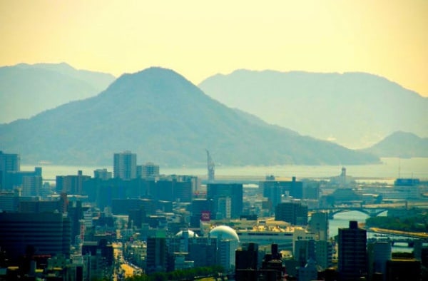
6. Mount Tachibana & Mount Mikatzuki (Fukuoka)
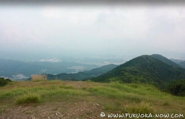
http://fukuoka-now.com/en/2013/08/hiking-in-fukuoka/
A 36-minute train ride from Hakata Station you'll find the start of the Tachibanayama trail. After hiking Mount Tachibana you can continue on to the easier hike up Mount Mikazuki.
For more details on the Tachibanayama and Mikazukiyama hikes, click here. More hikes in Fukuoka can be found at Fukuoka Now.
Good luck and see you out on the trails!
Related Stories:
Sea to summit: Expat hikers trek from the Japanese coast to the peak of Mt. Fuji in awesome video
Love Japanese hot springs? At Nakadake Onsen in Hokkaido, you can dig your own!
Japan’s 30 best travel destinations, as chosen by overseas visitors
Read full story: en.rocketnews24.com